
Дополнительное описание
Highlights
Unified display of various items on one map
– Police forces, police cars and other police portables – Critical infrastructure such as water towers/power plants/chemical plants, schools, churches/mosques, etc. – Risky objects such as lowlands, slopes, rapids and sewers – CCTV camera – Checkpoint – Various sensors such as water, smoke and infrared sensors – Show/hide button for each element layer.
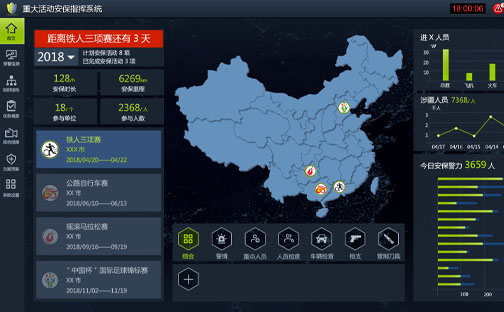
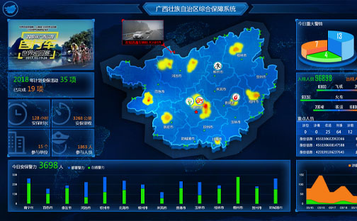
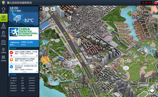
Presentation of comprehensive information on the main page
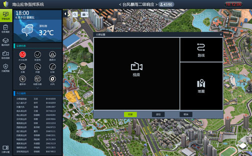
– Data on key people, such as people entering/exiting a particular region, persons on probation and parole – Police incident data – Map – Video monitoring of key areas on a rotating basis – Deployment of police forces – Weather information, especially typhoons and storms.
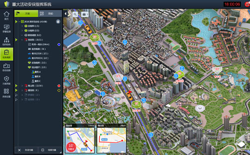
Powerful and user-friendly route safety plan design
– Draw the route with the mouse on the map – Set up guide and tail vehicles – Deploy a security post along the route – Enable existing security cameras along the route – Train with simulated GPS data to test the deviation warning – Train to test the security cameras along the route.
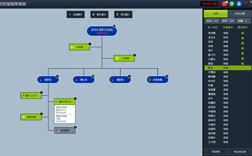
Monitoring and allocation of resources during the event
– GPS position check – SMS for notification/pre-warning – Roll call – SMS and call directly to the map – Select resources by circle or rectangular tool selection to perform DGNA.
Multiple warning/monitoring measures for route safety
– Notification of start time, countdown/delay warning – Notification of surrounding resources such as cameras or checkpoints – Warning of approaching dangerous infrastructure such as low land, slope or overpass – SMS for notification/warning – Automatic playback the nearest surveillance cameras along the guide’s route.
2.5D and 3D Map Integration
– Richer geographic and infrastructure information for more accurate decision making and accurate distribution.